 Processing by Intermap Vertical Accuracy:
• Moderate Terrain - 10-20 meters
• Hilly Terrain - 10-20 meters
• Mountainous Terrain - dependent on terrain steepness expect 15-30 meters
* Vertical Bias without Ground Control Points: 35 meters Map Sheet (Tile):
30' x 30' (~55 km x 55 km)
DEM Postings:
50 meters (~2.1 million points per tile)
*Accuracy can be improved with the use of Ground Control Points.
Accuracy depends on the source and distribution of the supplied control points. | Item# | Description | Price Each (U.S.) | | IM101 | Intermap RADARSAT DEMs | Call for quote | 3 Meter DEMs From Intermap's STAR-3i IFSARE Airborne Radar
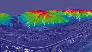
Intermap's STAR-3i system is a high-end airborne interferometric radar mapping system. Providing 3 meter DEMs, these are the most accurate DEMs available from a remote sensing source with no ground control survey. The rate structure for STAR-3i data is very project dependent however typical projects range from $60 to $110 per sq. km depending on terrain. Mountainous areas require double look for complete coverage. DIGITAL ELEVATION MODELS (DEMs)
Vertical Accuracy:
• Moderate Terrain - 3 meters
• Hilly Terrain - 3 meters
• Mountainous Terrain - dependent on terrain steepness - expect 3-5 meters
* Vertical Bias without Ground Control Points: 3 meters Map Sheet (Tile):
7.5' x 7.5' (~20 km x 20 km) DEM Postings:
25 meters |