 Domestic and international 3D contours and DEMs are generated from the original map source or the mylar separates, or digital files. 3D contour index and intermediate lines are captured in DXF format. DEMs are delivered in standard ASCII format. • Derived from largest scales available, custom or standard postings, all contour lines captured and attributed, DEMs completely smoothed.
• Derived from USGS 7.5', 15', or 1-degree quadrangle maps• Domestic and international DEM availability
• 30 meter, and 3 arc-second grid postings
• Standard DEM format 3D Vector Contours
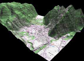
Land Info 3D Vector Contour data provides users with an important analysis tool for watershed, conservation and variety of other terrain evaluations. Contours are produced directly from color topographic paper maps. Following high resolution scanning, the image is filtered through a proprietary software application that extracts all colors, leaving only the contour lines. The image is then "cleaned", eliminating any peripheral data not related to contour information. The map is then assembled using a semi-automated vectorization process. Next, all gaps, spurs, or non-contour features are cleaned from the map. All map contours are attributed based on elevation or Z values and exported as a DXF file format. Each map is quality checked to ensure accuracy. |