MapRender 3D Software
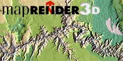 MapRender3D terrain modelling and visualization software package creates high quality relief maps in both 2D and 3D graphics using either a supplied world wide elevation database or other DEM files.MapRender3D features many advanced controls including custom rendering, projection selection, rotation, sizing, exaggeration, texture draping, lighting, shading, selective elevation color graduation, and a wide range of import and export formats.MapRender3D in addition to it's wide range of data import formats is supplied with a world data integrated into five seamless compressed databases, each at a different scale. Also supplied are twenty-seven projected world maps, fourteen special maps of the oceans, poles and hemispheres, and more than one hundred projected country and continental maps. These maps are in USGS Digital Elevation Model (DEM) format.
| Description | Price Each (U.S.) |
| MapRender 3D | $295 |
To order call Toll Free 1-888-333-GEMI or shop online!