| 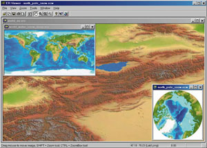 TerraColor™ World is a set of high resolution, color shaded terrain and bathymetry images of the earth. Over 20GB of world and regional images are provided on a single CD-ROM in ECW compressed image format with a variety of map projections. TerraColor™ World is a set of high resolution, color shaded terrain and bathymetry images of the earth. Over 20GB of world and regional images are provided on a single CD-ROM in ECW compressed image format with a variety of map projections.
The CD-ROM includes free viewing/export software (ER Viewer®), and plug-ins to use the ECW images in ArcGIS™, ArcView®, Autodesk® products, MapInfo®, Photoshop® and other products. Developed by Earthstar Geographics, TerraColor World is the low cost solution for anyone, from scientists to children, to explore the earth's terrain in detail from their desktops. TerraColor World is ideal for colorful world or regional basemaps, geography education, geologic and bathymetric studies, and more. The ECW plug-ins provide very fast zooming and panning of the these large (up to 2.6 GB uncompressed) images in your mapping application. The images are created from several public domain data sources including 1Km DEM data and 3.5Km bathymetric data. The ECW wavelet compression developed by Earth Resource Mapping reduces file sizes up to 50 times while maintaining image quality. |