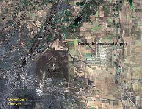
 You can see streams, wetlands, roads, buildings, and land-use with CARTERRA™ DOQ-5.
Space Imaging EOSAT's CARTERRA™ DOQ-5 product offers digital, orthorectified satellite imagery by the USGS quadrangle. DOQ-5 products combine the positional content of a map with the unique properties of an image for interpretation and analysis. Created using imagery from the Indian Remote Sensing (IRS) and the U.S. Landsat satellites, these products revolutionize the way you can order and use satellite imagery.
With the ability to order DOQ-5 products in a standard size, based on USGS quads, take advantage of smaller file sizes that are easy to handle on a desktop computer. Available as five-meter color or black-and-white images, these products are delivered in a reference system and formats you can use in virtually any CAD, mapping, or GIS software. CARTERRA™ DOQ-5P
Description: Five-meter panchromatic imagery provided in areas that coincide with USGS 7.5 minute quad boundaries.
CARTERRA™ DOQ-5C
Description: Five-meter panchromatic imagery colorized with either 25-meter or 20-meter resolution multispectral imagery and provided in areas that coincide with USGS 7.5 minute quad boundaries, digital or hard copy. |


