|
Emerge-Spatial:
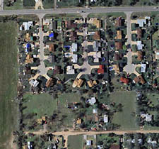
High Resolution Digital Aerial Imagery
Direct
Digital Image Solutions Best Value - Fast Turnaround
- Geometrically Accurate No Ground Control Required
With
a nation wide airborne presence and semi-automated image
processing, Emerge has the ability to collect, process
and deliver digital image products at a fraction of
the time and cost as compared to digitized film offerings.
BENEFIT:
Direct digital ortho-rectified products are typically
half the cost of digital orthos which are created with
film. These savings result from our semi-automated ortho-rectification
process, which uses digital elevation data only - eliminating
the need for expensive ground surveys. Access below
4,000 foot AGL cloud cover makes it possible to collect
imagery when other systems are prevented from collecting.
Imagery can be delivered in as fast as 48 hours in response
to emergency response.
APPLICATIONS:
• Transportation network maintenance and planning
• Corridor maintenance
• Urban planning (land use, tax assessment)
• Public safety (fire, rescue, law enforcement)
• Disaster assessement (forest fires, floods, tornado's,
hurricanes)
• Urban forest assessment and timber management
• Natural resource and environmental management
• Vegetation monitoring
• Wetlands mapping
• Facilities management
|
PRODUCT
SPECIFICATIONS:
|
| Imagery |
Final
Product |
•
1 Foot to 1-meter
• Wide Area, Linear or Point Targets
• Color or CIR
• Geo-registered
• 24 bits: 8 bits per channel
• Simultaneous acquisition of navigation
data obviates the need for ground control
|
•
Ortho-rectified Mosaic or Single Frame
• Meets 1:10,000 NMAS when ortho-rectified
with 7.5' level 2 DEM
• Compatible with GIS Image Processing
Software
• Three color 24-bit Tiff w/world file
• Delivered 14-20 weeks from order
|
| Item# |
Description |
Price
Each (U.S.) |
| E-Spatial
101 |
Digital
Aerial Photography |
Call
For Quote |
|
*Minimum
order size of $1500—possible ferrying charges
Prices start at $275-$375 per square mile for
one foot resolution data.
|
|