|

|

|
EOM July 2005 > Departments > My Position Is ...
Editorial: Human Interpretation
Matteo Luccio

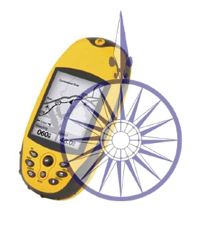
Figure 1: A compass rose and hand held GPS unit. Click on image to see enlarged.
Eight years ago, I was sailing a 32-foot sloop north along the Pacific coast of Washington state's Olympic Peninsula, only a few miles off shore. My sailing partner and I were alternating between the helm and our bunks, in four-hour shifts. When I stepped on deck at the start of my 20:00 to 00:00 shift and scanned the coastline in the moonlight, I could clearly distinguish a shape — perhaps a large rock or small promontory, I thought. An hour later neither the shape nor its bearing had changed appreciably. The same two hours later and then three... Yet, according to my GPS receiver, I was tracking over land at about 4 knots. That made sense to me, given the very light breeze we had. Talking to the Coast Guard over VHF radio on an unrelated matter, I mentioned this apparent discrepancy. They advised me to give them my position, per the GPS receiver, every half an hour, and I did.
When I returned to the helm at 04:00... I immediately saw that "the rock" was still there, just where I'd left it! I resumed my periodic reports to the Coast Guard and reiterated my puzzlement — which was quickly turning into bewilderment and anxiety. How could my GPS receiver and my compass bearings tell me opposite stories as to my position relative to the land? Was I caught in a strong current? Finally, at dawn, a fisherman who had been monitoring radio traffic on that channel all night, burst in: "That's no *%$!@ rock! That's Mount Olympus. It's 8,000 feet high and about forty miles away. At your speed, you could stare at it for hours and not see it move!"
What I lacked, in the dim light, was depth perception — and a third technology or method to referee between my compass and my GPS receiver. I did not have a Loran receiver and it was too cloudy for celestial navigation. (Not that I have ever studied celestial navigation, anyway.) As it turned out, both the GPS receiver and the compass were functioning properly. However, this being my first serious use of GPS, I questioned my ability to interpret the receiver correctly as soon as I was confronted with what appeared to be contrary evidence.
I was reminded of this story as I edited the articles for this month's issue and came across five related concepts. The first one is human interpretation of remote sensing data. Stephen White et al., for example, repeatedly describe the use of "visual examination" or "visual inspection" to quality-control the data produced by multiple sensors. In other words, no matter how much data we have, ultimately we have to interpret it. The second related concept is that of data fusion, discussed by Friedl et al. in their article on monitoring air quality. Data fusion is the process of inferring information by combining multiple data from one or more sources. For example, if one has aerial photos and electromagnetic survey data, one can combine these to give better inferences about geological structure than the use of either source alone would yield.
A third related concept is the use of complementary technologies. For example, in their article on monitoring air quality, Friedl et al. write: "Research and operational atmospheric measurements complement ground measurements to help understand pollution episodes and improve forecasts." White et al. write: "High-resolution, accurately geo-referenced digital photography was required to perform quality control on the LiDAR-derived shoreline and thematic maps derived from the hyperspectral cube." Coming from the world of GPS, I am particularly familiar with GPS-INS integration. GPS receivers do not cumulate errors but suffer from signal "occultation" when their antenna does not have a clear view of the sky — for example, in a tunnel. Inertial navigation systems, on the other hand, work anywhere but cumulate errors. By combining these two systems, you have the best of both worlds: the GPS receiver periodically corrects the INS and the INS takes over when GPS signals are not available.
Continued below ...

|
The fourth related concept is that of ground truthing. In his remote sensing tutorial, Raber writes: "Remote sensing applications are rarely successful without at least some direct measurements being taken within the study area. Often these measurements are referred to as 'ground truth.'" White et al. describe the use of black, grey, and white tarps to calibrate remote sensing equipment. In other words, validation of remote sensing data requires comparing it with known parameters.
The fifth related concept is that of control points. Raber describes the use of GPS receivers in the field to accurately locate features that are identifiable in remote sensing imagery, then writes: "The recorded locations of these features in the study area are collectively known as control points."
Accurate and reliable Earth observation requires that we combine all of these mutually reinforcing and correcting techniques.
Enjoy this issue of EOM and please send me your comments, corrections, and article proposals. ![]()
|
|
|
©Copyright 2005-2021 by GITC America, Inc. Articles may not be reproduced, in whole or in part, without prior authorization from GITC America, Inc. The original version of this article can be found at: https://www.eomonline.com/EOM_Jul05/article.php?Article=department1 |