| High-resolution DEMs Used in 3D Visualization, Image Processing & GIS
By Andrew Shepard and Amy Daniels Why High-resolution DEMs?
High vertical accuracies are important in many geospatial analyses. The quality and resolution of the digital elevation model (DEM) are two important DEM characteristics that can impact analytical results. For example, physical process-based watershed models and meso-scale atmospheric model simulations can be significantly affected by DEM quality and resolution. In this context, quality refers to the accuracy with which elevation values are measured, and resolution refers to the posted spacing and precision of the elevation values.
The advent of inexpensive global positioning system (GPS) receivers, capable of pinpointing locations with positional accuracies to the sub-meter level, has increased the need for precise geospatial data. In addition, many of the National Spatial Data Infrastructure (NSDI) primary framework datasets can be derived from high-precision DEMs and ortho-rectified imagery. 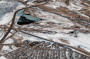
This IKONOS image of Morrison, Colo., was ortho-rectified using GT data and is draped over a GT bald-earth DTM, providing an example of the use of GT map products in 3D visualization. (IKONOS image copyright 2000 Space Imaging Inc.) Comparison of DEM Quality
The most widely available DEM products in the United States are produced by the U.S. Geological Service (USGS). The USGS 1:24,000-scale DEM data has broad accuracy standards and a rather coarse resolution. For instance, DEMs produced by the USGS are divided into three levels of increasing quality. Level One DEMs are produced by scanning National High-Altitude Photography Program or National Aerial Photography Program photography, or something equivalent. The post spacings of this data is 30 meters, and the vertical Root Mean Square Error (RMSE) of this data ranges from seven meters (the targeted accuracy standard) to 15 meters (the maximum permitted).
Level Two DEMS have been edited to remove identifiable systematic errors, and generally have a vertical RMSE of one-half the original map contour interval. Over the past decade, most of the DEM data produced by the USGS fall into this range.
Level Three DEMs are derived from Digital Line Graph (DLG) data by using selected elements from both hypsography (contours or spot elevations) and hydrography (lakes, shorelines or drainage). Major transportation features and ridge lines may be used for derivation as well. A RMSE of one-third of the contour interval is the maximum permitted. There is limited availability of Level Three DEMs.
The availability of DEM products with international coverage is even slimmer. NIMA's Digital Terrain Elevation Data (DTED) Level Zero is characterized by 30 arc second-post spacings (nominally one kilometer) and is geographically limited.
By contrast Intermap Technologies Global Terrain (GT) DEMs are posted at five meters, with vertical accuracies ranging from 30 centimeters to three meters and coverage of more than 600,000 square kilometers worldwide. Innovative Solutions
Intermap Technologies offers a GLOBAL Terrain (GT) database that provides highly accurate digital elevation models (DEM) and ortho-rectified radar image (ORRI) products from their STAR-3i system. These products are interoperable with most of the world's leading geospatial software packages that support image processing, GIS and 3D visualization. The technology involved in creating GT products is cost-effective and efficient, providing a product that offers much higher resolution than do current USGS datasets. Intermap creates DEMs and ORRIs with the STAR-3i
Interferometric Synthetic Aperture Radar (IFSAR) System mounted on a LearJet 36A. This system utilizes two X-band radar antennae for significantly more accurate DEM and image data as compared to previous radar imaging systems. The DEM data is accurate to 30cm RMSE and the ORRIs with 1.25-meter resolution. The inherent precision and speed of collection of the STAR-3i system has proven itself in operations all around the world.
The key to GLOBAL Terrain is interoperability. The packaging of file formats, projections, datums, and metadata was selected to optimize platform and software interoperability, thus assuring the widest applications. More than 10,000 GT digital elevation tiles (DSMs and DTMs) have been delivered in 7.5-minute quadrangles. These DEM map products are stored as 32-bit generic binary data files, which retain the high fidelity of the data while allowing them to be imported easily into major geospatial software packages. ORRI products are delivered as eight-bit GeoTIFFs, also supported by the vast majority of software packages. The standard projection of the GT data is UTM with WGS-84 as the horizontal and vertical datum, with reference to the EGM-96 ellipsoid, although delivery in other projections is possible. These projections were selected because they are commonly used, and also because they maintain uniform pixel size within each dataset. To ensure access to valuable data parameters about the individual GT map products, GT metadata is NSDI-compliant. GIS Applications
GT Products support ESRI ArcView, ArcIMS and ArcInfo GIS software users with base elevation and ortho-imagery layers for multi-level and multi-scale databases. Use of the DEMs as grid layers enable the computation of slope, aspect, and other terrain-related parameters in conjunction with other spatial analyses.
A detailed flood-risk analysis using GT products was conducted in 2000. The study, titled "Decision Support System for Flood Risk Analysis for the River Thames, United Kingdom," concluded that the combination of resolution and accuracy of GT data "proved ideal for the decision support system for regional flood risk assessment." The STAR-3i data provided Willis with a unique combination of high-quality DEMs and co-registered ORRIs, which allowed them to employ land-use information in the estimation of flood propagation. Image Processing Applications
GT products function within ERDAS Imagine, PCI, ERMapper and ENVI image-processing software packages which can create shaded relief images, fused image/DEM intensity hue saturation (IHS) images and can, using the ORRI and DEM, create ortho-rectified satellite or aerial imagery.
Image ortho-rectification is made easier with ground control points derived from the GT ortho-rectified radar image (ORRI). Ortho-rectification is further enhanced using bald-earth products created by TerrainFitTM, Intermap's proprietary algorithm that devises digital terrain models (DTMs) from the first-surface DEM. 3D Visualization Applications
GT products help create accurate representations of the Earth's surface and, with ortho-rectified, high-resolution imagery from satellites and aircraft, produce accurate 3D visualization with such software as Skyline TerraExplorer, ERDAS Virtual GIS, ArcView 3-D Analyst, and PCI Fly! Virtual tourism, land planning, games and entertainment, surveying, forestry, and weather modeling are only a few of the many applications of high-resolution visualizations. GT products can also be used for 3D visualization in aviation and auto navigation systems. Intermap is currently contributing DEMs to the creation of synthetic vision systems for NASA's Aviation Safety Program. What's Next for GLOBAL Terrain?
An ArcIMS interface to the GT Database is in the works, slated to be available online in April 2001. This interface will offer access to thumbnails, NSDI-compliant metadata and tools for locating specific areas of interest. Increased production of bald-earth products and topographic line map (TLM) products are also in process. More importantly, complete coverage of key geographic areas is on the horizon. About the Author:
Andrew Shepherd is customer service manager and Amy Daniels is distributor manager for GLOBAL Terrain. Both are based in Intermap's office in Englewood, Colo. Back |

